

")
Sierra Alhamilla is a mountain range that belongs to the Cordilleras Béticas. It is also the name of the Natural Area located in that range, declared by the Junta de Andalucia in 1989. The Natural Area extends through the municipalities of Lucainena de las Torres, Nijar, Pechina, Rioja, Almeria, and Tabernas, covering approximately 8500 ha. Its highest point is the peak of Colativi, 1387m. The climate of this range is sub-arid Mediterranean, with rainfall no higher than 350mm per year. Most of this rainfall takes place in autumn. The average yearly temperature is 14º C. Minimum temperatures can reach -7º C on the highest areas. There are usually 2 or 3 snowfalls a year.
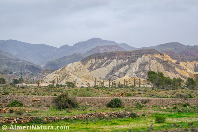
Geologically, Sierra Alhamilla belongs to the Penibetica Range, a geographic division of the Betic ranges, close to the coast, a feature that it shares with the ranges of Cabrera and Gador. The formation of this range was uplift due to volcanic activity, as shown by the volcano in Cerro del Hoyazo.
As a forest oasis between the Desert of Tabernas, the most arid area in Europe, and the Bay of Almeria it is of great ecological relevance. Given its value as an ecosystem, it is one of the Places of Community Importance (Lugar de Importancia Comunitaria-LIC) in Almeria. Some of the species of flora that can be found here are encinas and pino carrasco. Verbascum prunellii is an endemism exclusive to Sierra Alhamilla. As to the fauna, the variety of birds is outstanding, not in vain is Sierra Alhamilla an Area of Special Protection for Birds (Zona de Especial Proteccion para Aves –ZEPA). There is a great presence of wild boar and, amongst other species, genets, badgers, and weasels can also be found.
(Adapted and translated from Wikipedia)

