
")


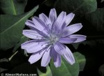
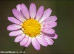
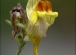
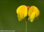


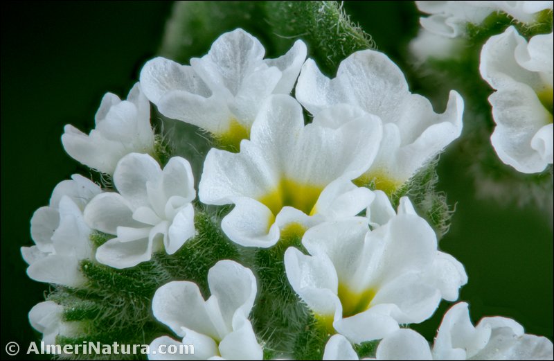
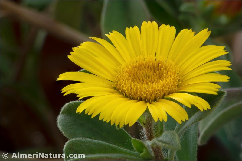
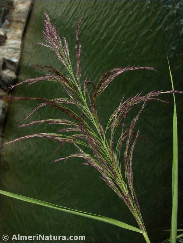
Flora destacada
Calificación
![]() En peligro crítico
En peligro crítico ![]() En peligro
En peligro ![]() Vulnerable
Vulnerable ![]() Casi amenazada
Casi amenazada ![]() No amenazada
No amenazada ![]() No evaluada
No evaluada
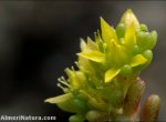
![]() Agrostis canina subsp. granatensis
Agrostis canina subsp. granatensis
![]() Androsace vitaliana subsp. assoana
Androsace vitaliana subsp. assoana
![]() Anthyllis vulneraria subsp. pseudoarundana
Anthyllis vulneraria subsp. pseudoarundana
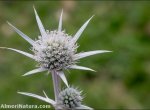
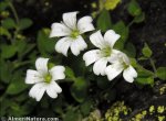
![]() Arenaria pungens subsp. pungens
Arenaria pungens subsp. pungens
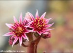
![]() Arenaria tetraquetra subsp. amabilis
Arenaria tetraquetra subsp. amabilis
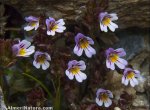
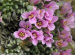
![]() Armeria filicaulis subsp. nevadensis
Armeria filicaulis subsp. nevadensis
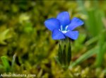
![]() Campanula rotundifolia subsp. willkommii
Campanula rotundifolia subsp. willkommii
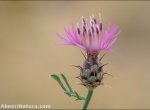
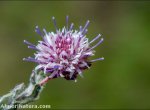
![]() Carduus carlinoides subsp. hispanicus
Carduus carlinoides subsp. hispanicus
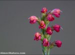
![]() Centranthus nevadensis subsp. nevadensis
Centranthus nevadensis subsp. nevadensis
![]() Cistus ladanifer subsp. africanus
Cistus ladanifer subsp. africanus
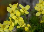
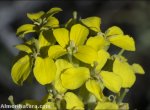
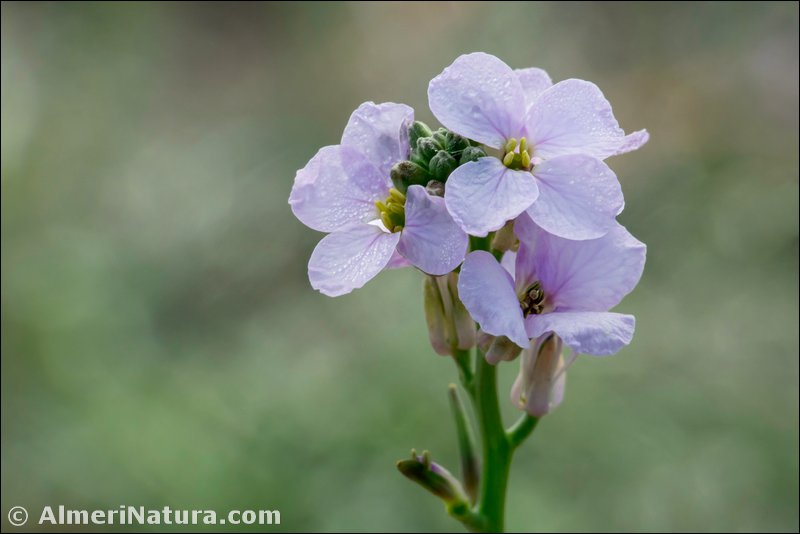
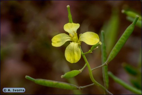
![]() Coincya monensis subsp. nevadensis
Coincya monensis subsp. nevadensis
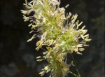
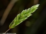
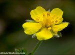
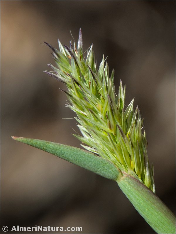
![]() Dactylis glomerata subsp. juncinella
Dactylis glomerata subsp. juncinella
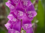
![]() Digitalis purpurea var. nevadensis
Digitalis purpurea var. nevadensis
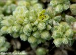
![]() Herniaria boissieri subsp. boissieri
Herniaria boissieri subsp. boissieri
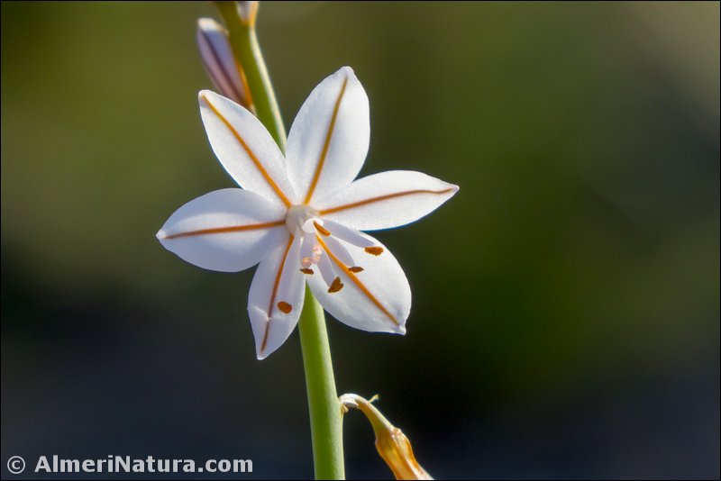
![]() Jasione crispa subsp. amethystina
Jasione crispa subsp. amethystina
![]() Lactuca perennis subsp. granatensis
Lactuca perennis subsp. granatensis
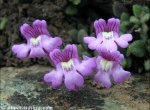
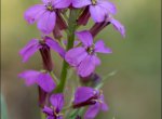
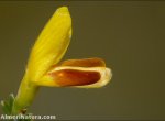
![]() Linaria aeruginea subsp. nevadensis
Linaria aeruginea subsp. nevadensis
![]() Linaria verticillata subsp. verticillata
Linaria verticillata subsp. verticillata
![]() Myosotis minutiflora subsp. minutiflora
Myosotis minutiflora subsp. minutiflora
![]() Nepeta amethystina subsp. laciniata
Nepeta amethystina subsp. laciniata
![]() Onobrychis argentea subsp. argentea
Onobrychis argentea subsp. argentea
![]() Phlomis crinita subsp. malacitana
Phlomis crinita subsp. malacitana
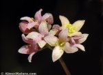
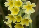
![]() Primula intricata subsp. lofthousei
Primula intricata subsp. lofthousei
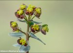
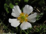
![]() Ranunculus cherubicus subsp. girelai
Ranunculus cherubicus subsp. girelai
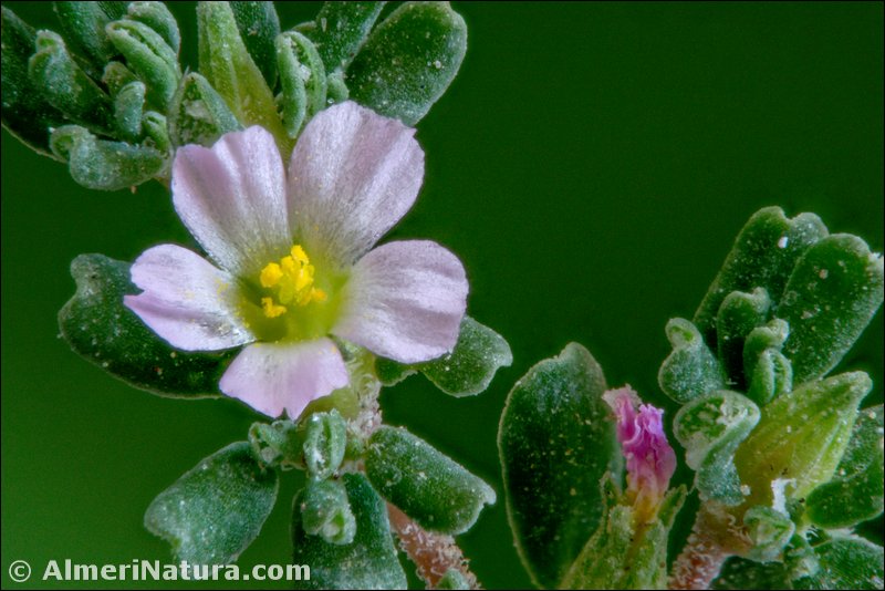
![]() Sagina saginoides subsp. nevadensis
Sagina saginoides subsp. nevadensis
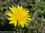
![]() Scorzoneroides carpetana subsp. nevadensis
Scorzoneroides carpetana subsp. nevadensis
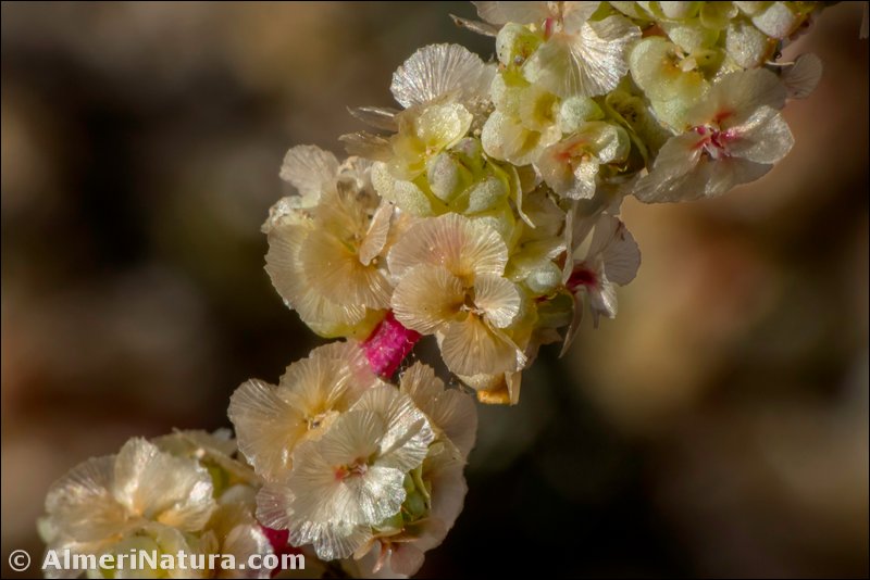
![]() Sesamoides purpurascens subsp. prostrata
Sesamoides purpurascens subsp. prostrata
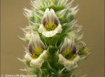
![]() Sideritis glacialis subsp. vestita
Sideritis glacialis subsp. vestita
![]() Thymus serpylloides subsp. serpylloides
Thymus serpylloides subsp. serpylloides
Otras plantas de interés
![]() Aquilegia vulgaris subsp. nevadensis
Aquilegia vulgaris subsp. nevadensis
![]() Cerastium gibraltaricum var. viridulum
Cerastium gibraltaricum var. viridulum
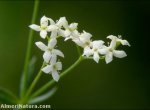
![]() Circaea lutetiana subsp. lutetiana
Circaea lutetiana subsp. lutetiana
![]() Cirsium acaulon subsp. gregarium
Cirsium acaulon subsp. gregarium
![]() Draba hispanica subsp. hispanica
Draba hispanica subsp. hispanica
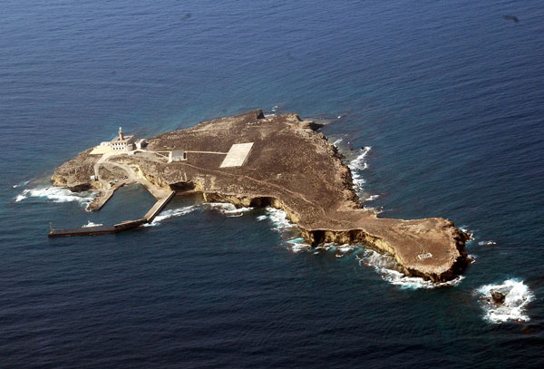
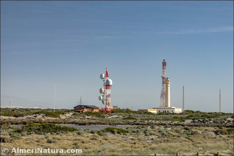
The Island of Alboran is an islet of volcanic origin located in the Mediterranean Sea, half way between the Coast of Almeria and North Africa.
The area of the Mediterranean Sea from Gibraltar to Cabo de Gata is named “Sea of Alboran”. It is located 48 nautical miles south of Adra and 35 n.m. from Cape Tres Forcas. The islet of La Nube and another little group of rocks is found 100 m to the north east of Alboran. In the center of the island there is an underground channel that goes through from one side to the other which is navigable in good weather conditions, called the Cave of Las Morenas. It has an area of 7.12 ha of volcanic rocks and guano. It is a wasteland shaped like a pear, 642 m long, 265 m wide and 16 m high. Located in an important seismic area where the African plate collides with the Eurasian one, it is the epicenter of a good deal of low-intensity earthquakes.
The island and its surroundings were declared a Marine Reserve and Fishing Reserve in 1997 and 2003. The parliament of Andalucia unanimously passed the law that declared the Island of Alboran, the islet of La Nube and the waters and sea beds surrounding it as Natural Area (Paraje Natural). It has also been an area of Special Protection for birds (ZEPA) since 2002.
Its Mediterranean waters, although with a marked influence from the currents from the Atlantic, supports a rich biodiversity and abundance of fish. Its seabed, covered by magnificent sea meadows of laminar algae and deposits of coral –red coral (Corallium rubrum) and orange coral (Astroides calycularis), has an important ecological value for which reason it has been declared a ZEPIM. On Alboran the land is bad. There are no trees nor drinkable water and the plants that they tried to plant did not grow. The reddish ground is covered with a brown miserable vegetation … a wasteland to the layman’s eyes, but fabulous for botanists.
(Adapted and translated from Wikipedia)
![]()
Flora of the Island of Alboran
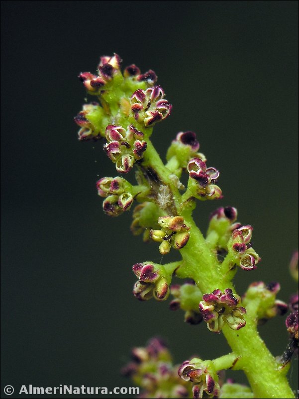
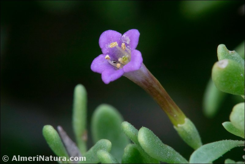
Se han citado en Alborán 20 plantas vasculares terrestres distintas, de las cuales Diplotaxis siettiana es un endemismos exclusivo de esta isla. El tomillo sapero (Frankenia corymbosa) es la planta más extendida de la isla, que junto con el algazul (Mesembryanthrmun nodiflorum), constituyen la vegetación dominante. Otra planta interesante presente en Alborán es la malva mauritánica (Malva durieui).
La lista del resto de plantas sería la siguiente: Anacyclus valentinus (A. alboranensis), Asphodelus sp., Cakile maritima, Chenopodium murale, Echium plantagineum, Frankenia pulverulenta, Halogeton sativus, Heliotropium europaeum, Lycium europaeum, Mesembryanthemum crystalinum, Ploycarpon tetraphylum, Salsola kali, Senecio leucanthemifolius (S. alboranicus), Spergularia bocconei, Sonchus tenerrimus y Triplachne nitens.
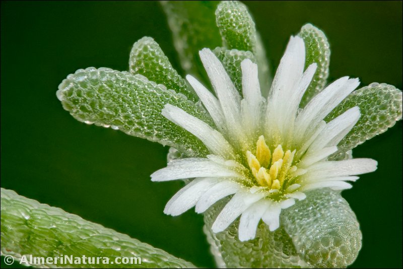
Diplotaxis siettiana Maire
Esta especie fue descrita en 1933 por el insigne botánico francés René Charles Maire (1878-1949), cuya obra magna es Flore de l’Afrique du Nord. El género Diplotaxis fue establecido en 1821 por De Candolle y alude a la disposición de las semillas en doble fila, en cada lóculo de la silicua, en la mayoría de sus especies. El término específico honra la memoria del naturalista Sietti, que descubrió la planta y es autor, entre otras publicaciones, de Nouvelle contribution a l’histoire naturelle de l’île d’Alboran (1933).
Especie extinta en estado silvestre; en la actualidad ha sido reintroducida y se lleva a cabo un plan de recuperación. Su hábitat está muy transformado. El área de extensión actual de la población es muy reducida. Está protegida a niveles regional y europeo.
De nombre vulgar "jaramago de Alborán". Está incluida en el Libro rojo de la flora vascular amenazada de España, con la calificación de "En peligro crítico", en la Lista roja de la flora vascular española y en la Lista roja de la flora vascular de Andalucía.
Según Flora ibérica, en la isla de Alborán se localizaron unos 140 ejemplares en 1974. Posteriores expediciones, de 1984 a 1990, no consiguieron encontrar ningún ejemplar. Recientemente se ha procedido a una reintroducción de plantas obtenidas a partir de las semillas recolectadas en 1974.
Según el citado Libro rojo…, la superficie de ocupación real es inferior a 0,003 km2 y la población estudiada corresponde a reintroducciones realizadas (1995-2000) con plántulas obtenidas de semillas de bancos de germoplasma. Este jaramago compite en desventaja con otras especies mejor adaptadas a la creciente nitrificación de los suelos de la isla. La germinación de D. siettiana en jardines botánicos es buena.
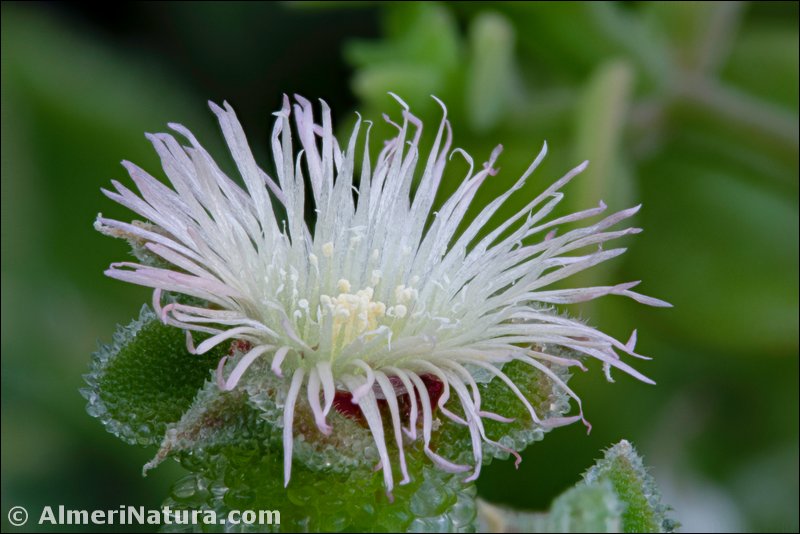
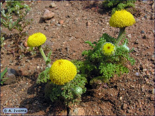
Anacyclus alboranensis Esteve & Varo
 Flora Ibérica considera esta especie sinónimo de A. valentinus, "al no presentar caracteres morfológicos (v.gr., grado de división foliar, tamaño de los aquenios y forma de las alas de los aquenios) que de forma concluyente permitan diferenciar las poblaciones de Alborán del resto."
Según el Atlas y libro rojo de la flora vascular amenazada de España, la superficie de ocupación real es inferior a 0,05 km2. La especie cuenta con una sola población que incluye menos de 2.500 individuos, considerando que su hábitat es muy frágil y está sometido a perturbaciones importantes de origen humano. Está protegida a nivel regional.
Especie muy amenazada, pues la Isla de Alborán es un ecosistema muy frágil y cualquier alteración podría llevar a su desaparición. Las visitas incontroladas, la presencia humana, las construcciones y el aumento de la población de gaviotas son los factores más importantes de riesgo.
De nombre vulgar "manzanilla de Alborán". Está incluida en el Libro rojo de la flora vascular amenazada de España, con la calificación de "En peligro crítico", en la Lista roja de la flora vascular española y en la Lista roja de la flora vascular de Andalucía. Su germinación en jardines botánicos es buena.
Anacyclus alboranensis fue descrita por Esteve y Varo en 1972
Senecio leucanthemifolius Poir.
(Senecio alboranicus Maire)
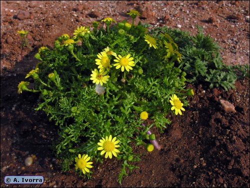
Vive en suelos rocosos, arenales nitrificados, muros, cerca del litoral. Se distribuye por la región Mediterránea e Islas Canarias. Islas Baleares, isla de Alborán y algunas localidades aisladas en la Península. En Almería se halla en la isla de Alborán y Cabo de Gata.
Las plantas de la isla de Alborán se describieron como Senecio alboranicus Maire y fueron incluidas en el Libro rojo de la flora vascular amenazada de España, con la calificación de "En peligro crítico". También en la Lista roja de la flora vascular española y en la Lista roja de la flora vascular de Andalucía.
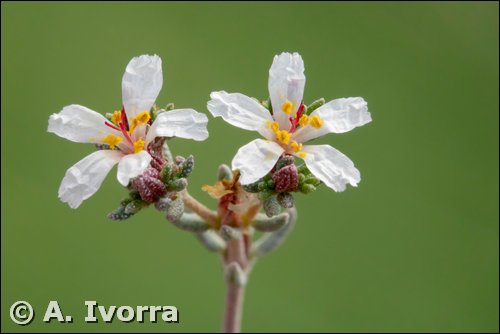
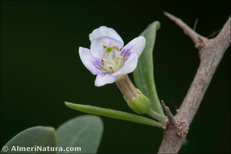
Malva durieui Spach
(Lavatera mauritanica Durieu subsp. davaei (Cout.) Cout.)
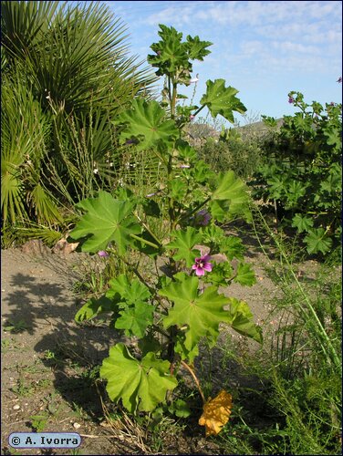
Vive en grietas de rocas costeras y arenas entre roquedos calcáreos. Se distribuye por España (Alicante, Almería, Cádiz, Castellón) y SW de Portugal. A veces cultivada en jardines botánicos, con lo que se hace subespontánea.
No se considera amenazada.
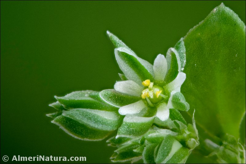
Frankenia corymbosa Desf.
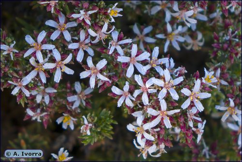
Vive en saladares, roquedos, depresiones salobres, arenales marítimos. Se distribuye por el NW de África y SE de España (Alicante, Almería, Granada, Murcia). En Almería es muy común sobre todo en el Desierto de Tabernas y la zona del litoral.
Nombre vulgar: tomillo sapero.
El término genérico honra la memoria de Johan Frankenius (1590-1661), médico y botánico sueco.
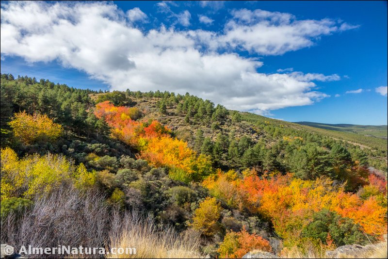
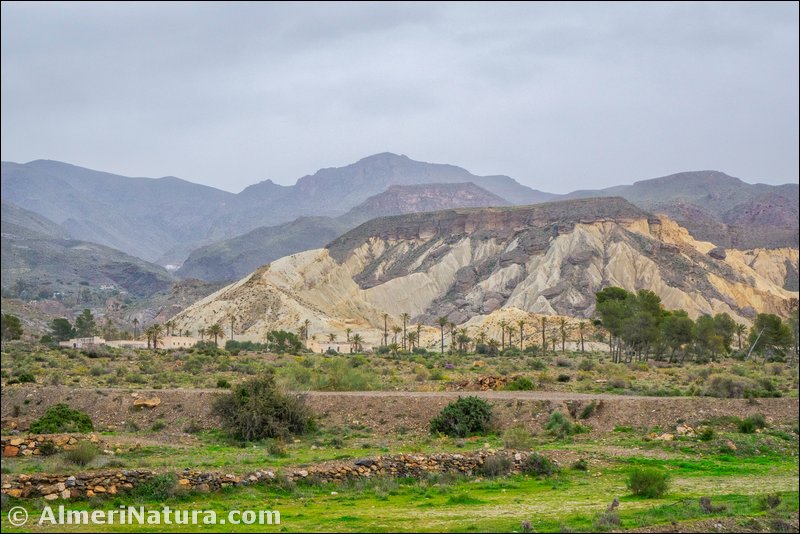
The Sierra de Los Filabres is the main mountain range in the province of Almeria, although the highest peaks of Almería are in Sierra Nevada, and it forms the southern limit of the Almanzora Valley. It is 50 km long and 25 km wide, with a total area of 150,000 ha. Along with Sierra de Baza, it makes a single range, but has a different name depending on the province where it is located, only being called Sierra de Baza in the province of Granada. Its average height is 1,500m, though we can find heights above 2,000m, like Calar Alto (2,168m), Tetica de Bacares (2,080m) and Calar del Gallinero (2,049m).
The materials that make up the range are a lower unit 5 km thick made up of schist-quartzite rocks from the Paleozoic age. Over this base-layer is a 1 km thick cover made up of schists and quartzites with insertions of carbonates and gneiss rocks, from the Permo-Triassic age. Locally, between the lower and upper layers there is another 1 km layer made up of metamorphosed limestones, marbles and several kinds of micaschists from the middle and upper Triasic
This sierra hosts an interesting flora. The matorral slopes up to 1500m consisting of genistas and esparto grass, give way to an understory of rockrose, savory and blue broom along with a forest of pine trees from an afforestation carried out in the 1960’s. Some outstanding species are: Centaurea sagredoi, endemic to Sierra de Los Filabres, Erodium rupicola, Erodium saxatile, Brassica repanda subsp. almeriensis, Pterocephalus spathulatus, Astragalus peregrinus subsp. warionis, Primula elatior subsp. lofthousei and Saxifraga trabutiana, amongst others.
(Adapted and translated from Wikipedia)


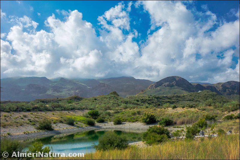
Sierra Cabrera is mainly located within the municipalities of Turre and Mojacar. At it’s highest it is nearly 1000m high - La Mezquita being at 962m and Arraez at 919m - which is why it occasionally gets some snow.
Sierra Cabrera’s landscape is marked out because of its higher rainfall compared with the rest of eastern Almería, in addition to the marine humidity that it receives. This makes this range a green island.
Most of the range, above all around the cortijos (farmhouses), is moulded by man and appears to be full of abandoned terraces and the remains of old irrigation ditches and ancient orchards. We can still see remnants of its farming past in the form of carob trees, almonds, olives, figs, pomegranates and grapevines; without forgetting the naturalized prickly pears and agaves.
The basal areas of this range are formed of siliceous materials, while the higher zones are mainly made up of limestone. In the areas between them, numerous springs can be found. Also, siliceous materials tend to prevail on the sunny slopes, while on the shady slopes, limestone is more abundant.
Sierra Cabrera was, until the 18th century, covered by cork and holm oaks but the axe, the plough, and grazing caused them to disappear in the end. Of the old cork oaks (Quercus suber) that populated the range, only a few remain. Being over 100 years old, they have an invaluable natural, ecological and genetic value, as they are a rarity in the Spanish south east and unique in the region. A similar fate befell the holm oaks (Quercus ilex), currently only appearing as small stands on the summits, along with Quercus rotundifolia, Kermes oak (Quercus coccifera) and Juniper (Junperus oxycedrus).
In the area known as Los Murtales, pine trees (Pinus halepensis) have been replanted.
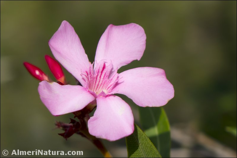
The current vegetation is made up of mediterranean bushes, like broom, thorn bushes, rockrose, anthyllis, rosemary, thyme, gorse and esparto grass. Among them occur Dwarf Fan Palm (Chamaerops humilis), Lentisc (Pistacia lentiscus), Olive (Olea europaea) and Mediterranean Buckthorn (Rhamnus alaternus). Around the numerous springs, gullies and humid water courses other species grow, such as Oleander (Nerium oleander), Southern Nettle Tree (Celtis australis), White Poplar (Populus alba) and Walnut (Juglans regia). In other exceptionally wet places Quercus faginea and Strawberry Tree (Arbutus unedo) grow, along with the above mentioned cork oak. Despite their scarce number, these make up the botanic jewels of the range due to their ability to survive in such a dry environment as the Almeria-Murcian area, where they are extremely rare. Other very interesting species are Sea Lavender (Limonium estevei) exclusive endemism to Sierra Cabrera, Toadflax (Linaria oblongifolia subsp. benitoi), Vetch (Vicia altissima), Narcissus (Narcissus tortifolius), Germander (Teucrium freynii) and Corydalis (Ceratocapnos heterocarpa) amongst others.
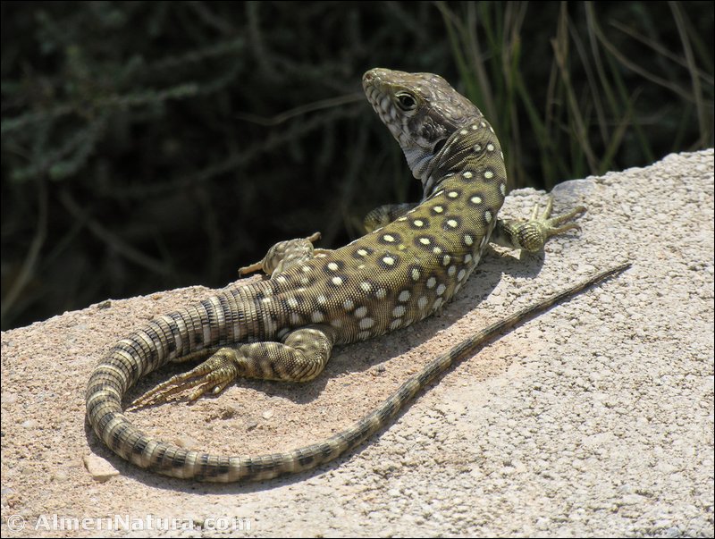
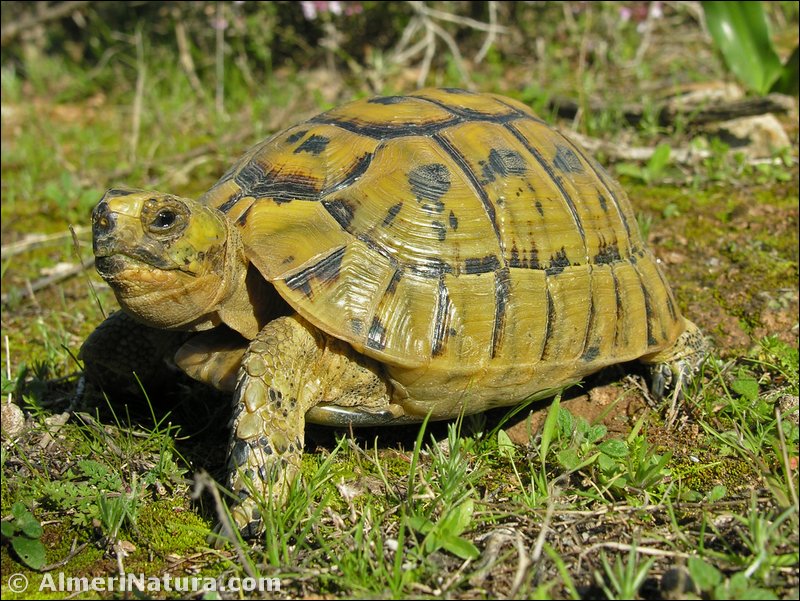
As to the fauna of Sierra Cabrera, we have boars, foxes, martens and badgers as mammals. There are several species of birds, and various raptors. As to reptiles, the Ocelated lizard stands out and there is an important population of the endangered Moorish Tortoise (Testudo graeca). Several species of amphibians can also be found in ponds. Some hunted species such as red partridge, rabbit and hare are still to be seen.
(Adapted and translated from Wikipedia)


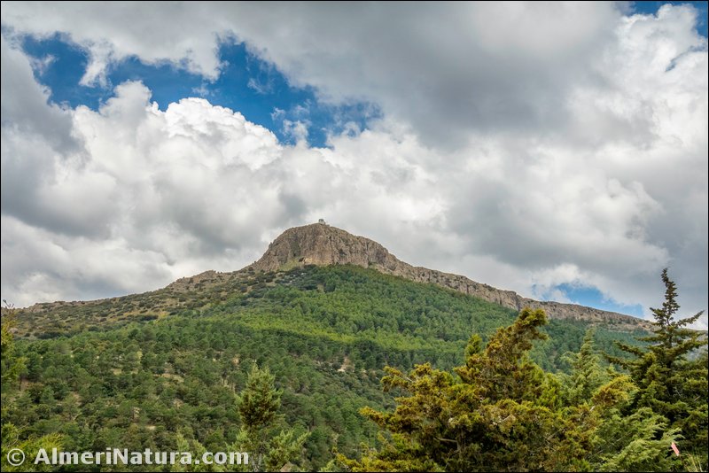
Sierra de Lucar is located in the municipality of the same name in the Almanzora valley. Well known because of Piedra Lobera, a steep greyish promontory whose name comes from a tradition that says that it was here that the last wolves of these sierras were exterminated.
The peak of Lucar, at 1722m, crowns Piedra Lobera. It is a spectacular limestone formation with steep walls that stand out over the landscape. Surrounded by a wide area of protected land, it was declared a Natural Monument on the 23rd of November 2001.
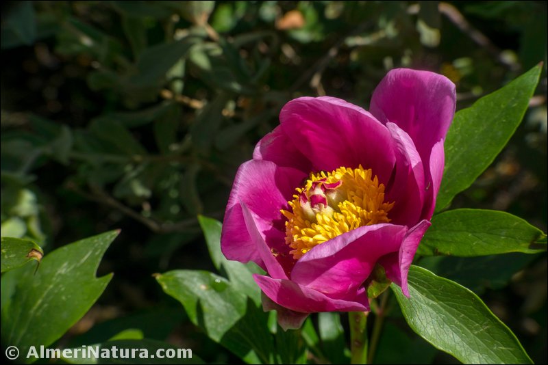
In addition to the beautiful landscape, this Natural Monument supports an important flora, adapted to the hard conditions of this environment: scarce rainfall, strong winds, long periods of hot sunshine, frequent freezing and rocky soils. Thus, species like the Sandwort (Arenaria tomentosa), appear out of the rocks, forming pads to counter the gusts of wind, they are also covered with small hairs to reflect the persistent solar rays. We can also find the Gooseberry (Ribes uva-crispa subsp. austro-europaeum), that lives in the shelter of the limestone cracks. The exotic Peony (Paeonia broteri), that we call mountain rose, can also be found here. Finally, up to 5 species of Saxifrage can be seen here, known as ‘stonebreakers’, like Saxifraga camposii subsp. leptophylla or Saxifraga erioblasta.


Sierra de Gador is a mountain range located in the southwestern tip of the province of Almeria. Its maximum height is 2,249m (Morron de la Launilla). Other heights are Pecho Cuchillo (1,968m.), Dos Hermanas (1,991m.), Nuevo Mundo (2,107m.) and Morron de los Franceses (2,236m.). It is 50 km long and 20 km at its widest, with a total area of 86,000 ha. It lies between the Sierra Nevada to the north, the Mediterranean Sea to the south, Sierra Alhamilla to the east, and Sierra de La Contraviesa to the west. At its foot is the “Poniente” region of Almería, traditionally called the “Campo de Dalias”. It extends over the municipalities of Felix, Enix, Gador, Alhama de Almeria, Alicun, Huecija, Illar, Instincion, Ragol, Fondon, Laujar de Andarax, Alcolea, Berja, Dalias and Vicar. The zone above 1,800m is known locally as “El Pelao” which can have very low temperatures in winter. In this cold zone can be area found vestiges of the most southern glaciation in Spain, such as seasonal pools and small lakes like El Sabinar.
The climate is sub-desert, though there are great contrasts as this range extends from sea level to over 2,000m. Especially important are the frequent and ephemeral winter snowfalls, as they refill the aquifers of its southern side.
Sierra de Gador hosts a very interesting flora, so the fact that it does not have any kind of protection status is not understandable. Its main woodlands are made up of reafforestation carried out over the last third of the 20th century, though it is still possible to find wide areas of Holm Oak, and in the wettest areas, small forests of Acers and Portuguese Oak. On the summits, brooms are predominant. Of the rich and varied flora, plants endemic to this range, Alyssum gadorense, Astragalus tremolsianus, Gadoria falukei, Hypericum hispanicum and Seseli intricatum stand out.
As to the fauna, invertebrates are the most numerous group, butterflies standing out for their importance, this Sierra being listed as an area of special lepidopterological interest. The presence of more than 130 species of birds make it one of the richest zones for ornithology in the province too. There can be found raptors like the Eagle Owl, Little Owl, Short-eared Owl, Golden Eagle, Bonelli’s Eagle, Hobby, Merlin and Kestrel. Among the mammals, the most significant presence is the mountain goat, coming from the nearby Sierra Nevada. Much more numerous is the wild boar that is found all over the territory. As to small predators, along with the endangered bobcat, foxes, genets, weasels and badgers are abundant.
(Adapted and translated from Wikipedia)


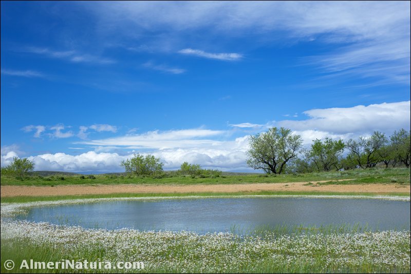
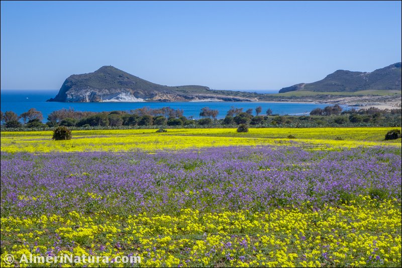
 The Natural Area of Punta Entinas-Sabinar and the Nature Reserve that it includes, is located in the municipalities of El Ejido and Roquetas de Mar. The Natural Area has an area of 1944.76 ha, while the Nature Reserve has an area of 785 ha. It is made up of a string of dunes, close to the Mediterranean coast, amongst which plenty of ponds can be found (called “charcones”), giving different biotypes within a Mediterranean sub-arid ecosystem. The annual average temperatures are around 18º C, while the annual average rainfall is between 200 and 250 mm. The main threats to this natural site are the proximity of intensive cultivation under plastic (tents) and the urban expansion due to tourism in the area.
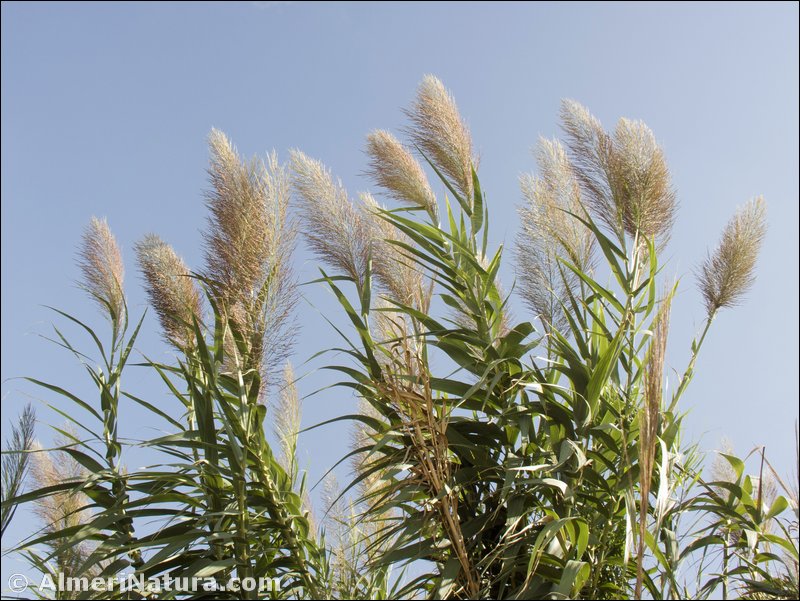
The main species of flora that can be found in this ecosystem are the “sabinas suaves” or Phoenicean Juniper (Juniperus Phoenicea), that gives the name to the place – Sabinar, and the Lentisc (Pistacia lentiscus). On the most saline land, the halophitic vegetation of the Chenopodiaceae family (glassworts and saltworts) proliferate. In general we can find the following plants all over the Natural Park, “cambroneras” or Tea Tree (Lycium intrincatum), Giant Reed (Arundo donax), Sharp Rush (Juncus acutus), “bolaga” or “bufalaga marina” (Thymelaea hirsuta), Ziziphus (Ziziphus lotus), Sea lavander (Limonium angustebracteatum), Yellow Sea Aster (Asteriscus maritimus), “roqueta de mar” or Sea Rocket (Cakile maritima) and “carrizal” (Phragmites australis). Some parasitic plants like Cynomorium coccineum or the rare Phelipanche olbiensis. The most outstanding flora is Ononis talaverae, Scrophularia frutescens and Wahlenbergia lobelioides subsp. nutabunda. The presence of the very rare fungus Beenakia mediterranea, is also remarkable. The seabed is rich in flora and fauna too, including the most western undersea meadows of Posidonia oceanica in the Mediterranean.
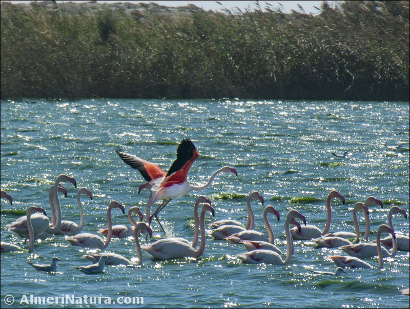
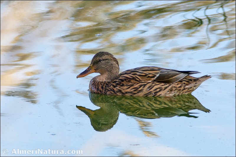
As to the fauna, the ornithological interest of this area is remarkable, where hundreds of bird species can be observed, such as Audouin’s Gull (Larus audouinii) and Flamingo (Phoenicopterus ruber). All over the Natural Area in its pools, live outstanding species, many of them listed as vulnerable or endangered, such as Coot (Fulica atra), Mallard (Anas platyrhynchos), White-headed Duck (Oxyura leucocephala) and Dunlin (Calidris alpina).
(Adapted and translated from Wikipedia)


Sierra Alhamilla is a mountain range that belongs to the Cordilleras Béticas. It is also the name of the Natural Area located in that range, declared by the Junta de Andalucia in 1989. The Natural Area extends through the municipalities of Lucainena de las Torres, Nijar, Pechina, Rioja, Almeria, and Tabernas, covering approximately 8500 ha. Its highest point is the peak of Colativi, 1387m. The climate of this range is sub-arid Mediterranean, with rainfall no higher than 350mm per year. Most of this rainfall takes place in autumn. The average yearly temperature is 14º C. Minimum temperatures can reach -7º C on the highest areas. There are usually 2 or 3 snowfalls a year.
Geologically, Sierra Alhamilla belongs to the Penibetica Range, a geographic division of the Betic ranges, close to the coast, a feature that it shares with the ranges of Cabrera and Gador. The formation of this range was uplift due to volcanic activity, as shown by the volcano in Cerro del Hoyazo.
As a forest oasis between the Desert of Tabernas, the most arid area in Europe, and the Bay of Almeria it is of great ecological relevance. Given its value as an ecosystem, it is one of the Places of Community Importance (Lugar de Importancia Comunitaria-LIC) in Almeria. Some of the species of flora that can be found here are encinas and pino carrasco. Verbascum prunellii is an endemism exclusive to Sierra Alhamilla. As to the fauna, the variety of birds is outstanding, not in vain is Sierra Alhamilla an Area of Special Protection for Birds (Zona de Especial Proteccion para Aves –ZEPA). There is a great presence of wild boar and, amongst other species, genets, badgers, and weasels can also be found.
(Adapted and translated from Wikipedia)


 The natural richness of the province of Almeria is reflected in several protected natural areas:
- One National Park: P.N. of Sierra Nevada, shared with Granada, where we can find mountain goats and wild boar, as well as an abundance of flora, unique in the continent.
- Three Natural Parks: Cabo de Gata-Nijar, declared in 1987 and the first maritime-terrestrial in the country. It is probably one of the last strongholds of virgin coast in the Mediterranean. It has a number of endemic xerophytic plant species and, until a few years ago, was sanctuary to the last monk seals in Europe. Another is Sierra de Maria-Los Velez. It has great areas of pines and populations of the scarce Moorish tortoise. Lastly the Sierra Nevada again, those areas under 2000m.
- There are also five Natural Areas: Alboran, Desert of Tabernas, Karst en Yesos de Sorbas, Punta Entinas-Sabinar and Sierra Alhamilla. The most important of them might be considered to be the first two Natural Areas: The Desert of Tabernas is technically the only desert in the European continent. It is an exceptional ecosystem and its peculiar landscapes have been used by the cinema industry from the beginning of the 60’s. The nearby Karst in Yesos of Sorbas is a complex of caves, canyons and other karstic phenomena carved by the Rio de Aguas in a deposit of gypsum near the village of Sorbas.
- Two natural reserves: Albufera de Adra and Punta Entinas-Sabinar.
- Five natural monuments: Reef of Barrera de Posidonia, Island of San Andres in Carboneras, Island of Terreros and Isla Negra in Pulpi, Piedra Lobera and Sabina Albar in Chirivel.
- And a peri-urban park: Castala in Berja.
- Two other remarkable natural features in the province are the giant olive tree in Agua Amarga, one of the most long-lived in the European continent and the gypsum geode of Pulpi, one of the biggest on the planet.
- There are also several centers of recovery, conservation and study of fauna and flora in the province. Some of them are:
- The Rescue Park of Saharian Fauna in Almeria.
- Botanic Garden of Albardinal in Rodalquilar (Nijar).
- Botanic Garden of Umbria de la Virgen in Maria.
(Adapted and translated from Wikipedia)
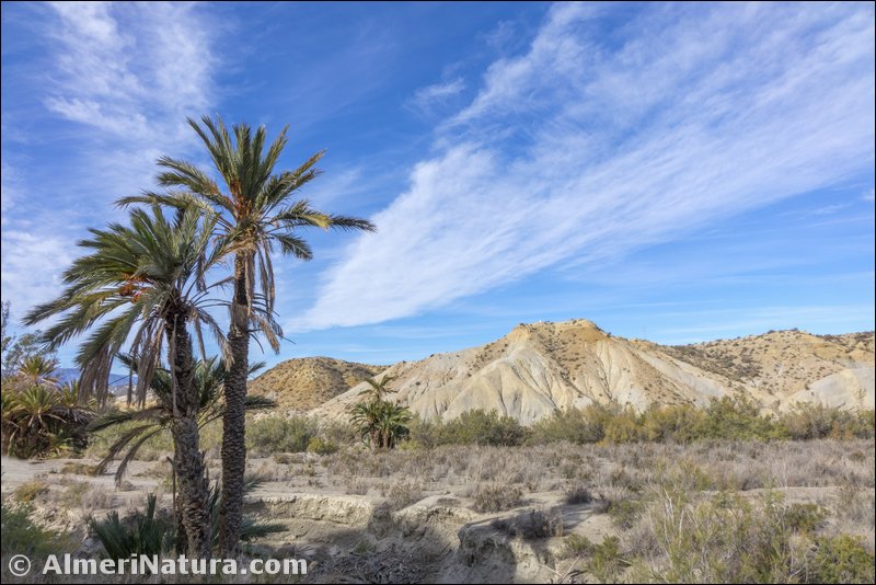
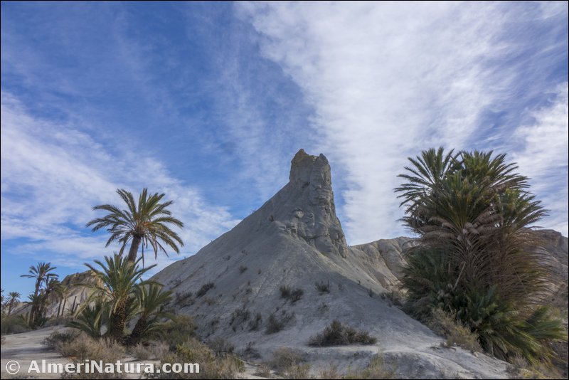
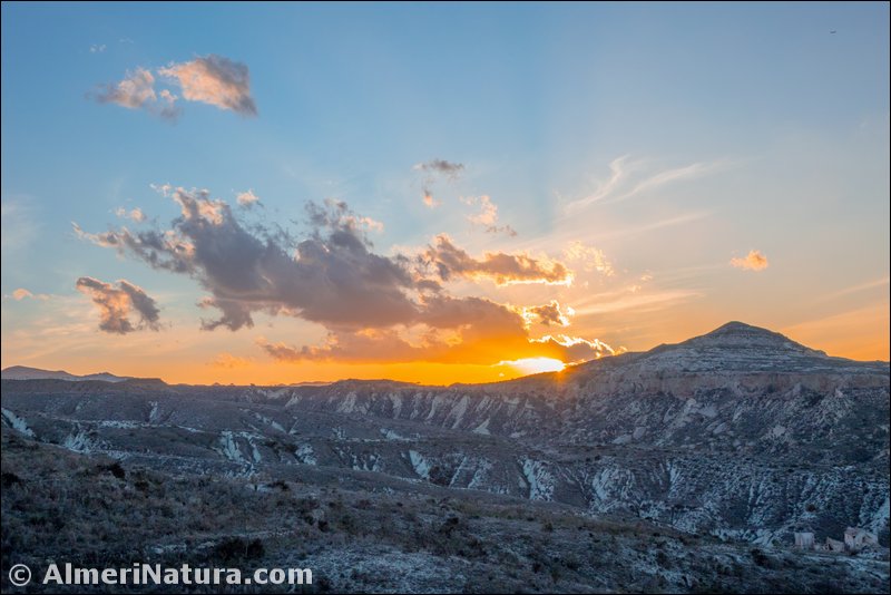
The Desert of Tabernas is located about 30 km north of Almería city in the municipalities of Tabernas, Gádor, Santa Fé, Alboloduy and Gérgal. Protected as a Natural Area, it covers 280 square km.
Some plants have developed small hard leaves to reduce transpiration, even photosynthesising during the night, like Anabasis articulata that colonizes a great part of rambla margins (dry river beds). Some ephemeral plants lack the necessary systems to withstand the long droughts, like Linaria nigricans. Nevertheless, they have a very accelerated metabolism and very short vegetative period. Their seeds can germinate and grow very rapidly, completing their evolution in a short time, enough to bloom and generate new seeds which await the next wet season. Other species confront the harshness of this environment by being succulent, or having the capacity to store water inside, like Apteranthes europaea. Other techniques are to develop large roots to capture superficial water which causes separation between plants, or vertical roots looking for underground water, or by having organs indifferent to solar radiation, like bulbs, tubers, or rhizomes. The presence of prickles is one of the defensive systems that a great number of bushes and shrubs have developed.
 There are also parasitic plants that obtain fluids from the roots of other plants, like Cynomorium coccineum. Some of the most common species are salsola, esparto grass, and the aromatic thyme (Thymus hyemalis and Thymus baeticus) and artemisia that help to fix the soil. On rambla margins, different species can be found that take advantage of the underground water, like tamarisk, broom, oleander, and fig trees, and bushes like the endemic Limonium tabernense, the pink Limonium (Limonium insigne) or and Almeria’s rockrose (Helianthemum almeriense), both endemic to the south east of Spain. We can also find plants like the rare Moricandia foetida, that blooms after spring rains on clay slopes. The numerous ramblas scattered in these burning landscapes are the only ecologically different elements in the desert. In these microclimates generated by the underground water, bushes of tamarisk and oleander grow where nesting birds find shelter, like the serin, blackcap and turtledove. In this area there are also real oases around water springs which are almost always saline, that cause the growth of dense salt tolerant vegetation, in which sedges and tamarisk compete with saltworts, salsolas and other Chenopodiaceae, one prevailing over the other depending on the amount of soil salinity.
 The distribution of fauna depends on several factors such as the presence of water sources or the humidity of ramblas, and the areas of sun exposure or shade. We can differentiate two kinds of main habitats - hills and ramblas. The abundance of bees and other insects that drink nectar, make up the main diet of some species such as bee-eaters, which make their nests in deep holes carved in rambla slopes so that they are protected from predators such as the horseshoe whip snake (Coluber hippocrepis). Red-legged partridge nest in the esparto covered hills. Peregrine falcons, Bonelli's eagles, and Golden eagles that live in Sierra Alhamilla use these areas as their hunting territory. Eagle owls hunt rabbits and small rodents. There are also foxes which hunt at sunset and in the night. A number of birds nest on the slopes of the ramblas; stock doves, kestrels, little owls, jackdaws, crag martins, alpine swifts, wheatears, sparrows, and also trumpeter finches that usually live in Saharan oases. The small tamarisk groves and the vegetation beside the ramblas are the preferred places for several species of birds, such as warblers, goldfinches, serins, golden orioles and even water birds like sandpipers, plovers and egrets. We also have steppe birds like dupont’s and thekla larks, stone curlews and little bustard. Mammals are more limited due to the aridness of the land, although rabbits, hares, dormice, and European and Algerian hedgehogs are abundant. In ramblas, amphibians like common frogs and natterjack toads, reptiles like red-tailed lizards, ocellated lizards and ladder snakes are also abundant, and can be found in any suitable habitat.
(Adapted and translated from Wikipedia)


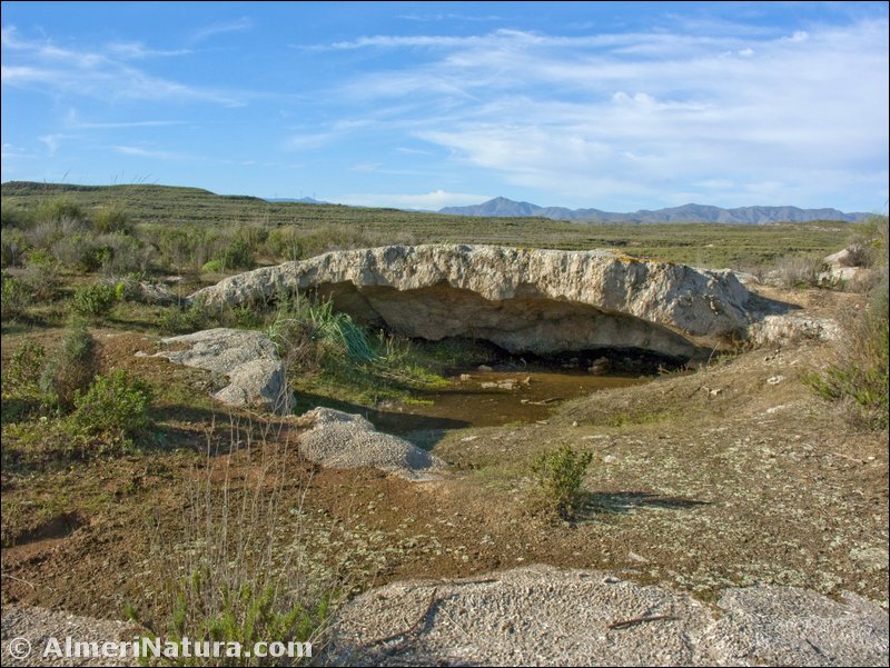
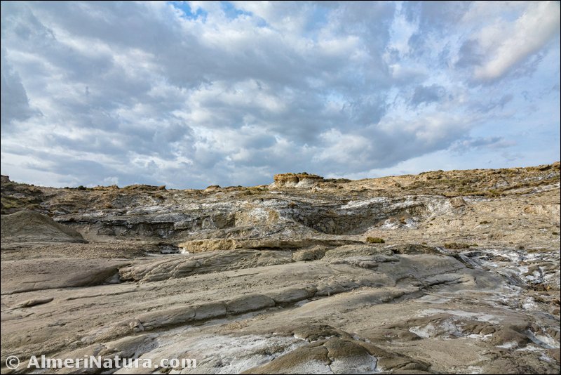
Karst en Yesos de Sorbas, with 2375 ha, is a complex of caves, canyons, dolinas, crystal geodes and other karst phenomena eroded by water in deposits of gypsum in the municipality of Sorbas.
With more than 1,000 caves, most of them interconnected, it is a spectacular universe of crystal formations: stalactites, stalagmites, columns and ‘coral’ formations. Its huge didactic and scientific value and its great speleological interest have made it one of the most important karst areas of gypsum in the world, one of the geological jewels of the planet. The system of Cueva del Agua, almost 8,500 m long, is the biggest underground system in gypsum in Spain, and second largest in the world.
Karst is produced in deposits of water soluble minerals (like gypsum or lime) in which the action of water from rivers or rainfall dissolves the rock and creates caves that, by partial collapse make dolinas, and by total collapse make canyons. The mineral dissolved by the water can re-crystalize in certain circumstances; for instance when dripping from the ceiling of a cave to the floor, it makes stalactites and stalagmites, or if it stagnates in a cavity, geodes can be formed.
Gypsum is a mineral that easily dissolves in water, this is why the process of karst formation is relatively fast (in a geological time scale). But this speed also causes its existence to be cut short (in the same time scale), as caves rapidly collapse and the deposits of gypsum almost completely disappear. This is the reason why there are very few karsts of this kind in the world, as most of them are very degraded. The low rainfall in Almeria has caused the karst process at Sorbas to be much slower than in other places, which is the reason why it is one of the best preserved in the world.
On the gypsum live some plants which are endemic to this area: Helianthemum alypoides and Teucrium turredanum. Other interesting plants are: Narcissus tortifolius, Chaenorhinum grandiflorum subsp. grandiflorum, Guiraoa arvensis and Santolina viscosa.
Also, one of the most emblematic species of southeastern Spain can be found here: the Moorish turtle (Testudo graeca).
The Junta de Andalucia declared this karst area a Natural Area (Paraje Natural) in 1989. There are two ways to visit the karst: on the surface touring its external landscape, or entering some of its caves to see the underground world. Speleologists have in the Karst en Yesos de Sorbas, an underground paradise.
(Adapted and translated from Wikipedia)

